Log in
All resources
Create a design
11,660 Free Images of Old Map
maps by willem and johannes blaeu
gemeente atlas van nederland - south holland
1860s maps of south holland
baroque
coats of arms on maps
joan blaeu
copper engraving print
british library
classicism
media from the national library of finland
leicester square
leicester house
old maps of marche
1624 maps of italy
guide joanne espagne et portugal-1915
1915 maps
gemeente atlas van nederland - south holland
1860s maps of south holland
maps by willem and johannes blaeu
old maps of harderwijk
maps by willem and johannes blaeu
old maps of sneek
maps of paris from bibliothèque nationale de france
philippe buache
old maps of great britain
1250s maps
palatinatus rheni (merian)
baroque
copper engravings
maps by hattinga
old maps of brabant
1666 in belgium
gemeente atlas van nederland - south holland
maps of wateringen
nicolaas samuel crucquius
old maps of delfland
maps by willem and johannes blaeu
old maps of jan mayen
old county maps of lancashire
copper engravings
gemeente atlas van nederland - south holland
maps of south holland
old submaps of paris 1er arrondissement
paris in the 18th century
old maps of the london borough of southwark
john rocque's 1746 map of london
maps of paris in the 1790s
1797 maps
a set of fifty new and correct maps of england and wales
old county maps of northamptonshire
gelehrtenschule des johanneums
maps of hamburg-altstadt
maps of béthune by braun & hogenberg
city walls of béthune
maps by willem and johannes blaeu
old maps of culemborg
maps from the earth and its inhabitants, vol. vi
maps of journeys
topographia franconiae (merian)
baroque
midden-delfland in the 18th century
maps of midden-delfland
maps of upper palatinate
old maps of bavaria
maps by willem and johannes blaeu
old maps of leiden
1590s maps of the levant
ptolemy's 4th asian map
carte de la mer mediterranée (1764) by roux
eran laor cartographic collection
old maps of north brabant
1645 maps of belgium
19th-century maps of the black sea
g. h. swanston
old maps of leopoldstadt
old maps of brigittenau
atlas maior, vol 11 (asia) - joan blaeu, 1667 - bl 114.h(star).11
1667 maps
old maps of haarlem
atlas van loon
gemeente atlas van nederland - south holland
1860s maps of south holland
merian sueviae
baroque
dienst der publieke werken
old maps of amsterdam
maps by girolamo porro
1598 maps of russia
old maps of kea (cyclades)
description de l'universe
maps in the library of congress
1655 maps of asia
maps from the earth and its inhabitants, vol. xi
1891 maps of africa
maps in cosmographia (münster)
old maps of kempten (allgäu)
island of california on world maps
1650s maps of the world
atlas maior, vol 2 (sweden, russia, poland, eastern europe, and greece) - joan blaeu, 1667 - bl 114.h(star).2
17th-century maps of estonia
1660s maps of spain
1667 maps
atlas maior, vol 1 (northern europe, norway, and denmark) - joan blaeu, 1667 - bl 114.h(star).1
1667 maps
maps of the western ghats
maps of rivers of india
sieges of the eighty years' war
conflicts in 1583
media from the national library of finland
classicism
1660s maps of spain
1667 maps
old maps of ghent by jacques horenbault
old maps of coupure (ghent)
athens in the ottoman era
old maps of athens
media from the national library of finland
classicism
old maps of north holland
maps of west friesland
maps from the earth and its inhabitants, vol. vi
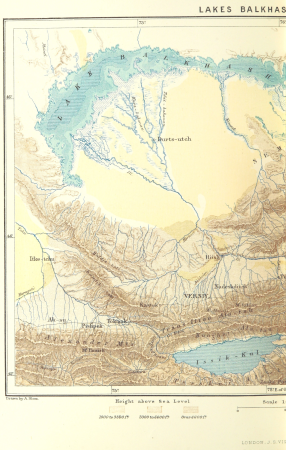
old maps of kyrgyzstan
maps from the earth and its inhabitants, vol. vi
old maps of kyrgyzstan
historisk atlas (stockholm, norstedt & söner, 1880)
old maps of the polish-lithuanian commonwealth
maps of paris by louis-joseph mondhare
maps of paris from paris musées
19th-century maps of the black sea
g. h. swanston
maps from the earth and its inhabitants, vol. vi
1891 maps of georgia
parchment
paper
maps of spain by tomas lopez
1780 maps of spain
1590s maps of the netherlands
1590s maps of belgium
maps by willem and johannes blaeu
old maps of amsterdam
old maps of kreis kleve
history of geldern
guide joanne espagne et portugal-1915
1915 maps
gemeente atlas van nederland - south holland
old maps of brielle
old maps of westerwolde
maps of vlagtwedde
details of old maps of moscow
antey theatre
maps by willem and johannes blaeu
maps of the duchy of limburg
voyages and travels to india, ceylon, the red sea, abyssinia, and egypt, vol. 3
henry cooper (engraver)
old maps of the history of oceania
maps by john cary
old maps of towns in england
arundel castle in art
old maps of seville
1788 maps
maps by jean-baptiste bourguignon d'anville
maps by thomas kitchin
nuremberg in the 1650s
baroque
gardens in north rhine-westphalia
romanticism
maps of landkreis elbe-elster
old maps of saxony
maps by willem and johannes blaeu
old maps of kampen, netherlands
maps of polders in south holland
old maps of delfland
locator maps of the harbour of rotterdam
maps of scheepvaartkwartier
old maps of the american revolution
1777 maps of quebec
media from the national library of finland
classicism
maps by willem and johannes blaeu
old maps of franeker
media from the national library of finland
classicism
gemeente atlas van nederland - south holland
1860s maps of south holland
gemeente atlas van nederland - south holland
maps of alblasserdam
algeria in the 1880s
old maps of algeria
old maps of wales
hugh hughes
topographia braunschweig lüneburg (merian)
baroque
old maps of the falkland islands
1901 maps of south america
lucas janszoon waghenaer
bretagne in the 1580s
gemeente atlas van nederland - south holland
maps of 's-gravenzande
eran laor cartographic collection
edward weller
media from the national library of finland
classicism
old maps of groningen (province)
maps by christian sgrothen
maps of the history of denmark
old maps of scandinavia
topographia braunschweig lüneburg (merian)
baroque
the french invasion of ireland in '98 (1890) by gribayèdoff
maps from the mechanical curator collection
7101 - 7200 of 11,660
Next page
/ 117